See photos (3)
Les Chemins de Collonge
Foot
in Collonge-la-Madeleine
8.8
km
Foot
Medium
-
Start - Mairie :
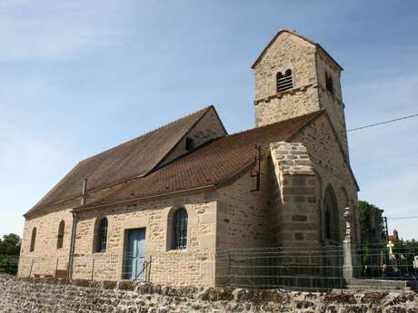
From the Mairie, take the RD232 (the church is on your right).
Turn right onto the first tarmac track between two buildings.
Towards the old Collonge mill:
Before reaching the pond of the old Collonge mill, fork right onto a dirt track.
Go past a large farm.
When you reach the road, turn right uphill and then left at the first junction.
Descend towards the Digoine valley:
The route passes over a plateau, then descends to the Digoine valley.
You will come to the main road...Start - Mairie :
From the Mairie, take the RD232 (the church is on your right).
Turn right onto the first tarmac track between two buildings.
Towards the old Collonge mill:
Before reaching the pond of the old Collonge mill, fork right onto a dirt track.
Go past a large farm.
When you reach the road, turn right uphill and then left at the first junction.
Descend towards the Digoine valley:
The route passes over a plateau, then descends to the Digoine valley.
You will come to the main road near a house.
Follow it to the right.
Just after the Château de Frétoy, turn right onto the small road that climbs towards Morlet.
Towards the plateau > Carrefour des Quatre Chemins :
When you reach the plateau (meadows), fork right onto a gravel path.
At the end of the track, turn left.
Continue for around 1 km to reach the Quatre Chemins crossroads.
Return along the ridge path:
Turn right onto the small tarmac road near the two litter bins.
(Do not take the first road on the right.)
The road becomes a dirt track of good viability.
At the end (picnic area), take the tarmac road to the right, then immediately the track to the left.
This path leads down to a pond and then to the small road leading to the village.
Return to the starting point:
Turn right and the road leads back to the starting car park after 1 km.
- Departure
- Collonge-la-Madeleine
-
-
Difference in height
- 154.139 m
-
-
-
Documentation
-
- Instuctions d'itinéraire - Les Chemins de Collonge
- Tracé GPX de l'itinéraire : Les Chemins de Collonge
- Tracé KML de l'itinéraire : Les Chemins de Collonge
-
- 154 meters of difference in height
-
- Maximum altitude : 453 m
- Minimum altitude : 363 m
- Total positive elevation : 154 m
- Total negative elevation : -154 m
- Max positive elevation : 62 m
- Min positive elevation : -57 m