Departure point :
From the car park, leave the cross on the left (alternative*).
Continue for 500 m, then at the crossroads with the Route de Bouton, take the downhill path on the right.
Towards Morgelle :
Go up the sunken track on the right.
Go down into the woods, then turn left at the crossroads.
Go up to the hamlet of Morgelle.
Turn left again for 150 m, then right onto a path that climbs.
After 500 m, turn left, then another 500 m on the ridge path to the road.
Turn left, then...
Departure point :
From the car park, leave the cross on the left (alternative*).
Continue for 500 m, then at the crossroads with the Route de Bouton, take the downhill path on the right.
Towards Morgelle :
Go up the sunken track on the right.
Go down into the woods, then turn left at the crossroads.
Go up to the hamlet of Morgelle.
Turn left again for 150 m, then right onto a path that climbs.
After 500 m, turn left, then another 500 m on the ridge path to the road.
Turn left, then immediately right onto a track leading down 500 m through the woods to a road.
Petit Moloy > Étang :
Turn right and walk 1 km to Petit Moloy.
Go past the pond, turn right, walk 50 m, then take the left-hand path through the meadows.
Continue for 750 m.
Towards Saint-Léger-du-Bois :
At the intersection (variant*), turn right towards Saint-Léger-du-Bois.
Go past the puits des Fourneaux (on the left).
After 600 m, turn right just after a bench.
After 300 m, you will come to La Chaume.
Cross the road (cross on the right).
Follow the tarmac track, which becomes a dirt track after the houses.
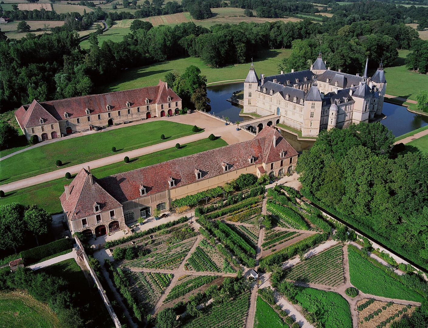
Go up 400 m to a crossroads, then turn left (view of the Château de Sully).
Drive 250 m to reach the D26 (entrance to Saint-Léger-du-Bois).
Turn left, then right over the Drée bridge.
Follow the road between the town hall (right) and the church (left) as far as Les Fontenys.
Turn left and follow the old railway line to the road.
Return via Sully :
Cross the road and continue straight ahead along the old railway line.
At the next junction (old post office), turn left.
At the junction with the D26, cross over and continue for 300 m.
Turn left at the crossroads, then take the first turning on the right.
Drive past the castle.
Cross the bridge over the River Drée and return to the starting point.
*Variant - Moulin de Sully :
After the château, turn left towards the Moulin de Sully.
Continue for 1 km to reach the Fourneaux intersection.
There are two possible loops from the intersection.